You’re not alone if you’re perplexed after learning that Kansas City is under a blizzard warning as a powerful storm system moves through the area Tuesday.
After all, snowfall amounts aren’t expected to be particularly high. Isn’t a blizzard more of a winter event involving a lot of snow?

Not exactly.
“Well, for this one, we’re looking at a blizzard warning because, really, we’re looking at these high winds,” said Ryan Cutter, a National Weather Service meteorologist in Kansas City. “A blizzard warning you would go with any time you get some snow and really high winds.”
There are no minimum snowfall requirements for a blizzard.

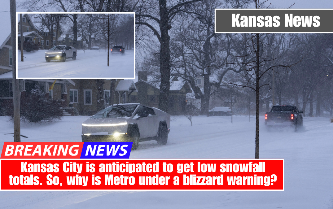
According to Cutter, snowfall totals in the Kansas City area will range from 1 to 2 inches.
“But with the wind speeds — they’re blowing around sustained 30 mph with gusts 50 or more — we’ll see where that snow ends up,” Cutter told reporters. “You’re going to have spots that get scoured clean and then spots where it just piled up because of the wind.”
The blowing snow will reduce visibility for anyone traveling, particularly those on east-west highways.

The weather service defines a blizzard as a severe snowstorm in which winds are sustained or frequently gusting at least 35 mph, falling or blowing snow reduces visibility to 1/4 mile or less, and these conditions last at least three hours.
Blizzard warnings are uncommon in Kansas City, according to data reviewed by The Star.
According to Iowa State University data, there have only been four other blizzard warnings issued for the five counties that comprise the immediate Kansas City metro area, which includes Wyandotte and Johnson counties in Kansas and Clay, Platte, and Jackson counties in Missouri, since 1986.
The warnings were issued on December 24, 2009, February 1, 2011, November 25, 2018, and January 5, 2025, for storms that occurred around those dates.
Cutter, who has worked at the weather service’s Kansas City office since September 2001, remembers the one issued in 2009, which he believes was their first.
“I remember we were sitting around the office debating and trying to figure out if we needed to do that or not because we hadn’t done that before because we hadn’t needed to do that, at least at that point in this office’s history,” Cutter told me.
Rain to transition to snow in Kansas City
According to Cutter, southerly winds were pulling moisture up from the Gulf as it rained in the Kansas City area Tuesday morning.
The rain was forming into a low-pressure system that would move across the metro area in the afternoon, deepening as it went.
As the low-pressure system deepens, Cutter predicts that powerful winds will develop and shift to the northwest. Western Kansas is already experiencing 50 to 60 mph wind gusts.
People will notice a lull before the winds begin to pick up. Cutter compared it to being in the eye of a hurricane.
“And then all of sudden, like an hour later, whack,” Cutter was saying.
Between 8 and 10 p.m., “you start to really notice the northwest winds kick up and start getting really blustery,” Cutter explained.
After midnight, sustained wind speeds will exceed 30 mph, with gusts reaching 50 mph or higher, especially early Wednesday.
Winds will remain around 30 mph by sunrise Wednesday at 6:45 a.m. The gusts will likely subside in the late morning, but strong winds are expected.
“The snow is almost incidental to the wind speed because winds speeds are really what’s going to cause the issue,” according to Cutter. “It’ll blow things around, reducing visibilities quite significantly, especially with the snow and wind combined, and then, yeah, causing all kinds of issues if you’re out.”
Restrict travel to emergencies only
People are encouraged not to drive overnight. If they do go out, it should be for emergencies only.
“It would not be a good idea, especially in high-profile vehicles,” Cutter told me. “Even if it wasn’t getting cold enough to turn to snow, 50 mph winds and rain is bad enough, let alone add snow, where your visibilities really do get reduced quite significantly.”
To make matters worse, the howling winds will bring wind chills into the teens.


